
Day 4: Leh to Nubra
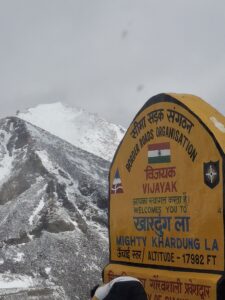
After going around Leh and seeing the local attractions, it was time to travel to Nubra. Nubra is a valley located about 150 km from Leh at an altitude of 10,000 feet above sea level. Compared to Leh, at about 11,560 feet, Nubra is at a lower elevation. However, the catch is, to reach Nubra from Leh, you will have to cross Khardung La, a pass at an altitude of over 17,900 feet! The day promised to be exciting, and indeed it was.
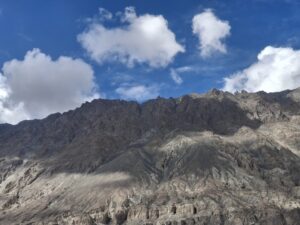
Just as we started, we filled our car’s tank near the Leh viewpoint at the start of the highway. A signboard at the HP gas station claimed it was the World’s highest-altitude retail outlet at 12,067 feet above sea level. Through the car’s window, one could see clear blue skies, brown mountains and dry roads, all signals of a pleasant journey ahead. As we drove towards the top, the journey was indeed pleasant, just that the surroundings began to change.
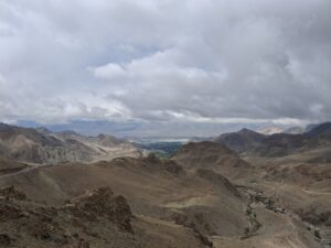
The temperatures started falling. The clear blue sky began to cloud over. A hailstorm followed, this time more intense than the brief one we encountered on the way to Kargil. The roads became wet and slippery. By the time we reached the top of Khardung La, the hailstones were hitting with a vengeance. Just as I got out of the car to click a picture at the top viewpoint, I couldn’t shake off a sense of giddiness from the high altitude. For the first time, altitude sickness started to take its toll. The air was thin, and you could feel the difference as you breathed.
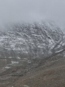
None of this deterred the flurry of tourists clicking pictures and recording reels while playing with ice. The other thing I noticed throughout the trip was that YouTubers/Instagrammers doing a push-up routine in front of landmark sites for shorts and reels seems to be a trend these days! Just like the petrol pump, there was also a cafeteria at that height, claiming to be the highest in the world! I also spotted a dispensary run by the army, perhaps to address health issues at the top. We didn’t spend much time at the top due to the rough weather and high altitude, and we restarted our drive towards Nubra Valley.
After about two hours of downhill driving, we crossed Khardung village and reached Khalsar junction. Back to blue skies and clear roads, but mountains with some green vegetation. At this junction, the road branches into two valleys – the Shyok Valley and the Nubra River Valley. We took the Shyok Valley route, with the Shyok River’s greenish-blue water flowing alongside towards Diskit, the commercial hub of Nubra and Hunder. Diskit is renowned for the Diskit Monastery, a 14th-century monument, and Hunder for its cold desert and sand dunes.
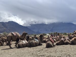
At Hunder, the authorities have developed a hub for outdoor activities. This hub, called the Sand Dunes Leisure Park, offers a variety of activities for tourists. From rides on double-humped camels to ATV (All-Terrain Vehicle) rides, we found the place buzzing with tourists of all hues. Very close to this place is the Milkha Point, where portions of Bhaag Milkha Bhaag were shot.
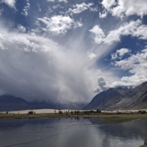
With a bout of nausea hitting right from Khardung La, getting to the hotel quickly, which was near Hunder, for some rest was the immediate priority.
Day 5: Nubra to Turtuk Village and back
The plan for the day was to drive to a small village called Turtuk, about 85 km from Nubra, and return by evening. Some context about Turtuk is in order. Turtuk today is a Muslim-majority region located in a Buddhist-majority district, in a Hindu-majority country. Geographically, linguistically and culturally, it is part of the Baltistan region, most of which is now part of Pakistan. Until 1971, Turtuk and three other villages along the LOC were part of Pakistan-Occupied Kashmir (POK). It is said that during the 1971 Bangladesh liberation war, on the 15th of December 1971, the inhabitants of these villages, who went to bed as Pakistan citizens, woke up to find themselves part of India!
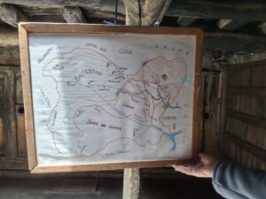
The Indian Army raided this part of POK and occupied it during the war. As part of the Shimla Agreement, these villages remain part of India and fall under the Ladakh administration. I learnt that after becoming part of India in 1971, Turtuk and the adjoining villages remained among India’s most isolated border villages for many years due to a lack of all-weather road connectivity. Therefore, food and supplies were sent to the area mostly by air, via military convoys, porters and mules.
Between the 80s and 90s, the Indian Army and the Border Roads Organisation (BRO) gradually built road infrastructure to connect this territory to Nubra. It was only in 2010 that Turtuk was finally opened to tourists. Even then, due to a lack of mobile connectivity and power for most of the day, tourism failed to take off. Things started changing in 2014. The advent of social media, vloggers, and bikers opened the place up to more tourists. The real explosion in domestic footfall began after the COVID-19 pandemic in 2020. The Indian government’s resolve to boost domestic tourism in the Leh-Ladakh region and its strategy to promote “border tourism” have made Turtuk a compelling part of the itinerary for all those planning a trip to Ladakh. More about what’s there in Turtuk and its significance later.
We left Nubra promptly at 9.00 in the morning and took the Diskit–Turtuk highway, which is mostly good but patchy in places. The drive is scenic, with many viewpoints offering panoramic views of the Shyok Valley. Our first stop was the Shyok War Memorial, built to honour the heroes of the Siachen Glacier and the Indo-Pak Wars. At first glance, the war memorial seems to be in the middle of nowhere, with only barren land and mountains in its vicinity. As you park the vehicle and walk towards the memorial, a sense of solemn gratitude and respect for the armed forces engulfs you. In fact, the respect one always had grows multifold. And this is not just for those on the front lines of the battlefield but for the entire ecosystem – the engineers, the medical staff, those who regularly drove convoys to move people and supplies, those who prepared the food, and so on.
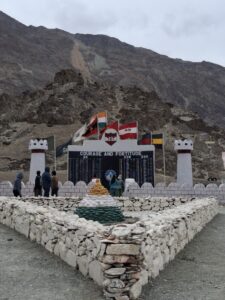
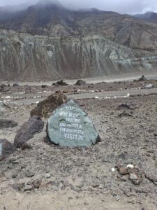
As you stand quietly in front of the monument, you are humbled by the terrain. It was then that I realised the purpose of constructing a war memorial in such a place, which is to make us realise the magnitude of the task at hand for the armed forces in protecting our borders. This location is considered one of the harshest military deployment zones. From this place, at a distance of about 110 kms, is the Siachen base camp, and from there to the Kumar Post (named after the legendary Indian Army mountaineer, Colonel Narendra “Bull” Kumar), which is one of the strategic nodes on the Siachen Glacier, is about 60 kms. More importantly, while the Siachen base camp is at an altitude of 12,000 feet, the Kumar Post is at an altitude of 15,600 feet, and the top-most point on the glacier is at about 20,000 feet. If one can feel the enormity of the terrain at the war memorial itself, with such bitterly cold winds blowing in what is supposed to be “summer”, one can imagine the conditions at the Siachen base camp or the glacier during extreme winter! Since 1984, when they occupied the Siachen Glacier, the Indian troops have maintained a continuous year-round presence through the harshest of winters.
From there, in less than one hour, we reached the village of Turtuk, which today stands as a testament to the Balti culture. As a village it is a photographer’s oops Instagrammer’s delight. Apricot blooms, mulberry trees (I haven’t tasted tastier mulberries in my life), vintage houses, the Yabgo palace, and Balti cultural and heritage centres are all part of the guided tourism routine these days. At the Yabgo palace, you can see the dynasty’s history, with a present member of the dynasty seated in his royal demeanour, explaining his pedigree to visitors.
Picture postcard views at Turtuk village
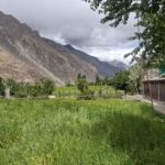
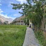
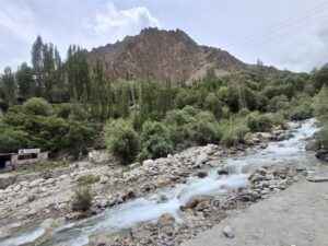
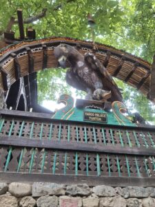
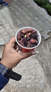
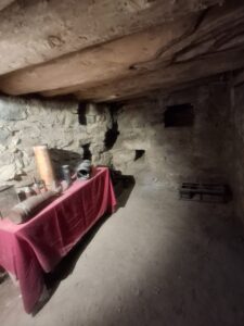
The people from the Balti community don’t call themselves Ladakhis but prefer to call themselves “Baltis” and are proud of their heritage. There are many restaurants and cafes that serve the Balti cuisine. For decades, the village lived under the constant shadow of heavy cross-border shelling. In fact, one of the places of interest here is the “bunker of memories”, which was used by a family here during the Kargil war of 1999. Almost all houses have such bunkers, we were told. Also of interest are the natural cold storage areas that are part of the houses.
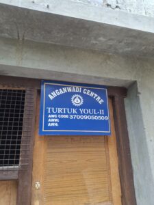
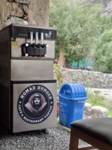
We had lunch at a local Balti restaurant named Nomad Hunger. The branding element included a portrait of Che Guevara. I guess this must be the second place in India that revered the Cuban revolutionary so much, the first being Kerala! I was pleasantly surprised to see Anganwadi centres and government primary schools established even in such remote areas to support child health and education. It is evident that the Central government and the local administration are doing their best to integrate the Balti community into the mainstream, using tourism as an important tool.
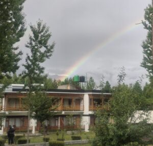
Today, the Balti community is more than happy to see the booming tourist economy here. They see India as a rainbow, born from the harmony of rain and sunshine, as a symbol of hope that brings cheer even after the darkest clouds. Just as we sighted a rainbow when we just reached our hotel back in the evening after an emotionally draining and interesting day!
To be Continued…
For Part 1: Click here.
For Part 2 : Click here.
For Part 4 and the final part: Click here
So well detailed, Anand. Great to read about the area, the people and the blend of the local history & culture. Super pics as well. Awesome 👌
Thank you so much, Alex. Really appreciate that you take the effort to leave your feedback always.
Superb post. Excellent clicks.
Wishing well
Thank you so much Neelakantan Sir for your feedback and constant encouragement.
Pingback: Altitude Matters: My Journey through Ladakh – Part 1
Pingback: Altitude Matters: My Journey through Ladakh – Part 2
Very detailed and excellent blog with Beautiful photos and videos Enjoyed reading and got a very good feel of the place . Thank you Anand . Keep writing
Thanks Pushpa! Appreciate your feedback and encouragement!