After last year’s Kailas Manasarovar Yatra, my tryst with high altitudes continued as we narrowed down on Ladakh for our vacation this year. Having experienced heights of about 18,000 ft during that Yatra, the Ladakh trip, with similar or lower heights, should not be difficult. Or so I thought. That acclimatisation is the key to all travel to high-altitude places is now well entrenched, not just in the brain but in the entire anatomy of the body. Therefore, the suggestion of travelling to Leh, the capital city of Ladakh, via Srinagar from Mumbai, rather than flying directly to Leh, which allows 2 days to get used to the high altitudes, made a lot of sense. Or so I thought. The fact that the Srinagar-Leh highway is one of the most scenic drives in India was another motivation.
Our 8-day trip to Ladakh began with a flight to Srinagar, after which we continued by road, reaching Leh via Kargil. Apart from covering places of interest in Leh, the plan was to cover places like Nubra, Shyok Valley, Turtuk, and Pangong Lake. Since a lot of information about these places is available all over the internet, I am not going to repeat it here, but rather share some interesting titbits, impressions, and, of course, experiences. Read on.
Day 1: Srinagar to Kargil:
As we landed in Srinagar and proceeded by road, the army presence was palpable. Understandably so, after what happened during the last holiday season in Pahalgam. But the interesting point is that, according to the driver, this was nothing compared to what it was a few years ago. In the midst of a busy tourist season, Srinagar’s roads were quite congested with heavy, slow-moving traffic until we left the city limits and entered the Srinagar-Leh highway (NH1). I must add here that the whole state was also gearing up for the Amarnath Yatra, which is to start on July 3 of this year and run till August 26. The Amarnath Yatra is one of the most significant events in the state’s annual calendar, and the entire administration throws its might into ensuring the smooth operation of the Yatra. That also explained the heavy army presence, I reckon.
Our first stop was Sonamarg in the Ganderbal district of Jammu and Kashmir, a small town offering breathtaking views. To reach Sonamarg, we passed through the newly opened 6.5 km-long all-weather tunnel connecting Gagangir and Sonamarg. If you are looking for picture-perfect postcards for your Instagram feed, you will find plenty here in Sonamarg. A decade ago, when you visited places of interest like the Taj Mahal, you would find professional photographers offering to click your pictures, print them, and deliver them to you. In the present era of Instagram, you will find youngsters offering to shoot catchy reels for you in these tourist places (Rs 300 per reel) that you can post on Instagram and improve your social media standing! Throughout this trip, we found many such professional “reelers” at vantage points, contributing to the “Orange Economy”!
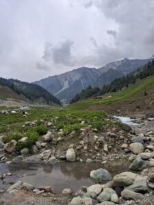
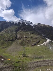
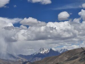
We then reached Zojila at an altitude of 11,629 feet. The weather changed quickly, and we also experienced a brief hailstorm as we reached the peak. Dramatic mountain views await you in Zojila. From a tourist point of view, Zero Point, which is also the border separating Kashmir and Kargil in Ladakh, used to be the main activity hub at Zojila. I say “used to be” because the administration has now cleared all the recreation points from here. So, at Zero Point, there are only viewpoints for pictures and reels. Currently, an underground tunnel is being constructed under the Zojila pass, which will make travel to Drass and Kargil faster. On the flip side, one cannot enjoy the mountains and views while zipping through the tunnel. It started raining soon, and in the span of the day, we experienced all kinds of weather! From the bright, sunny weather in Srinagar to a very pleasant one in Sonamarg to chilly, snowy surroundings at the top of the Zojila pass, and now a bit of rain, we experienced it all. Or so I thought.
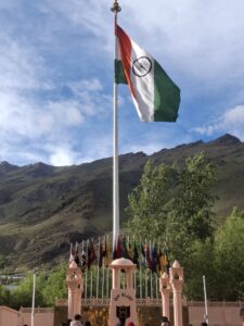
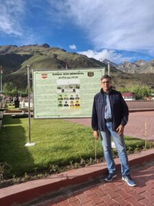
By 5.30 PM, we reached Drass, a place that entered our collective memory and conscience during the 1999 Kargil conflict. Drass, we are informed, is the world’s second coldest inhabited place. At Drass, the one place not to be missed is the Kargil War Memorial, built to honour the martyrs of the Kargil conflict. A profound sense of emotion grips you as you walk through the thoughtfully designed memorial. This emotion soon morphs into immense pride as you read the extraordinary stories of courage and sacrifice by the brave soldiers whose heroics secured our victory in Operation Vijay. Important landmarks such as Tiger Hill, the Batalik range, and the Tololing range serve as beautiful backdrops for the memorial.
Leaving Drass, we continued our drive through scenic landscapes and reached Kargil town by 7 p.m., checked into our hotel, and retired after what had been a long day since we left Mumbai.
Day 2: Kargil to Leh:
The day began with a short tour of Kargil town, nestled among the surrounding mountains. Truth be told, the first time we heard of Kargil was during the India-Pakistan conflict in 1998. Today, the town is one of Ladakh’s capitals and is quite developed. My impression of Kargil as just an army base camp quickly changed when I saw the town buzzing with tourists. The road, even at that altitude, was smooth like silk, and the views along the highway were beautiful.
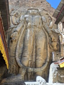
As per our itinerary, our first stop for the day was Mulbekh Chamba, home to the 9-metre (30-foot) tall statue of Maitreyi Buddha carved into a towering limestone cliff along the Srinagar-Leh Highway, 45 km from Kargil. It is one of the three tallest rock-cut statues of Buddha in Ladakh, collectively known as the Bamyan Buddhas of Ladakh. A casual walk around this place led us to one of the most picture postcard landscapes we’ve ever seen. There is a monastery close by, on top of the hill, called Mulbekh Monastery, which we skipped.
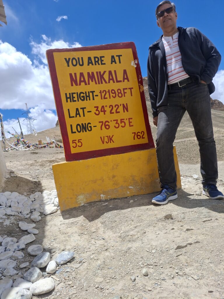
Our onward journey took us to Namiki La, a high mountain pass at an altitude of 12,198 ft in the Zanskar range of the Himalayas. The viewpoint at the top offers a 360-degree view of the mountainous terrain, and one can see a heavy army presence there, manning the pass. Namiki La is the first of the two passes we cross, the second being Fotu La. Fotu La is farther along on the same highway and at a higher altitude of 13,479 feet. Incidentally, the government has just approved the construction of the Fotu La tunnel project this month.
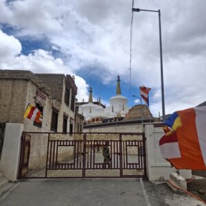
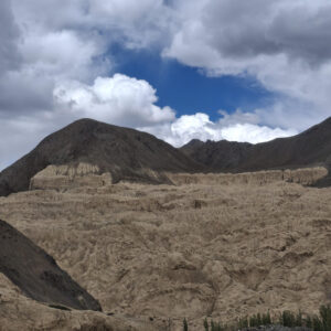
As we drove about 15 km down from Fotu La, we reached the Lamayuru monastery in the town of Lamayuru in Ladakh. Lamayuru is one of the largest and oldest gompas (Buddhist monasteries) in Ladakh. Apart from its beautiful exterior, the monastery also features exquisite mural paintings on its interior walls. After a quick lunch here in Lamayuru, we continued our road journey along a stretch known as the Moon lands, famous for its moon-like terrain, which was a fascinating sight.
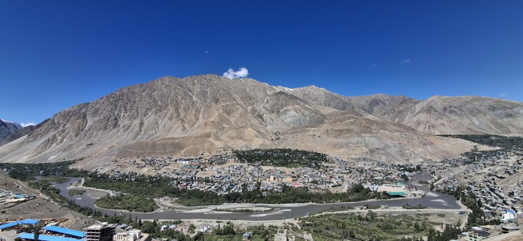
Finally, after a drive of over 6 hours, we reached Leh. We are now back at a height of 11,562 feet. Leh is the main capital of the Ladakh region, and once again, we can feel the ubiquitous presence of the Indian army throughout the town. The next day was earmarked for visiting the places of interest in Leh town. Despite two days of acclimatisation, sleep eluded me that night due to the drop in oxygen levels. But as the trip progresses, sleep would not be elusive. Or so I thought.
To be continued.